Hello Chuck,
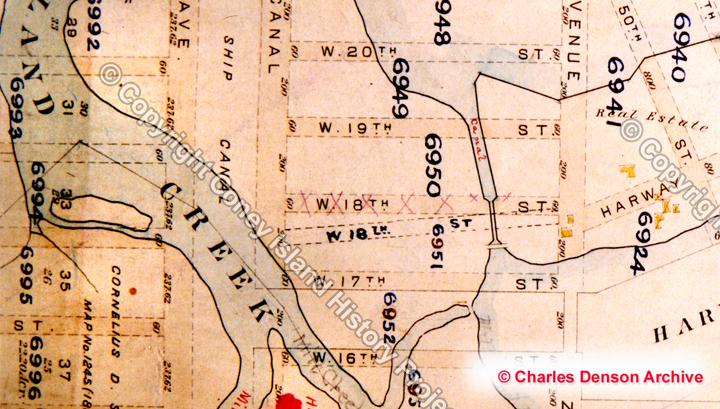
Coney’s mysterious missing streets are a puzzle that’s mystified anyone who’s lived in Coney Island. Why are 18th Street, 26th Street, and 34th Street missing? I’ve researched this over the years and can give my theories. When a new street grid for Gravesend was drawn up in early 1880 the existing roads and streets were plotted southward across the creek and into the West End of Coney Island, which at the time consisted of sand dunes and a few ramshackle hotels along the shoreline. Gravesend’s ancient roads and streets did not follow a true grid in the Manhattan sense, yet the newer streets were plotted as straight blocks running north/south. If an older street that ran at an angle that did not fit the new grid it was eliminated from the West End plan. As you can see from the maps, 18th Street followed an odd angle as it crossed Coney Island Creek so it was eliminated from the map.
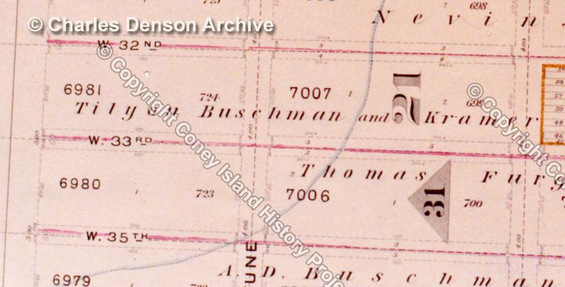
The other missing streets have something in common. They were both early subdivisions made in 1878 when Coney Island’s “common lands” were illegally divided and sold off by John McKane, the felonious supervisor of the Town of Gravesend. The 1878 map shows unusual property lines drawn east of 25th and 33rd streets and these imaginary lines coincide with the first subdivisions of the lands in the West End. The “34th Street” subdivision, from the Ocean to the Bay, was owned by Thomas Furgueson. The “26th Street” plot was owned by Charles Woolsey. Both men were cronies of John McKane. These imaginary lines correspond to the right-of-way for both missing streets and political favors may have something to do with why these two streets were never mapped.
Comments
Great stuff! When we lived on 16th, we"d send my somewhat dim brother on a wild goose chase to streets that didn't exist.
Add new comment